 Tibet World Travel Tibet Tour, Tibet Trip, Tibet Travel, Tibet Train, Tibet Trekking,
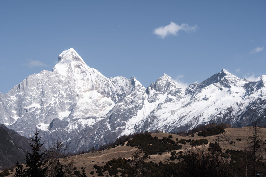
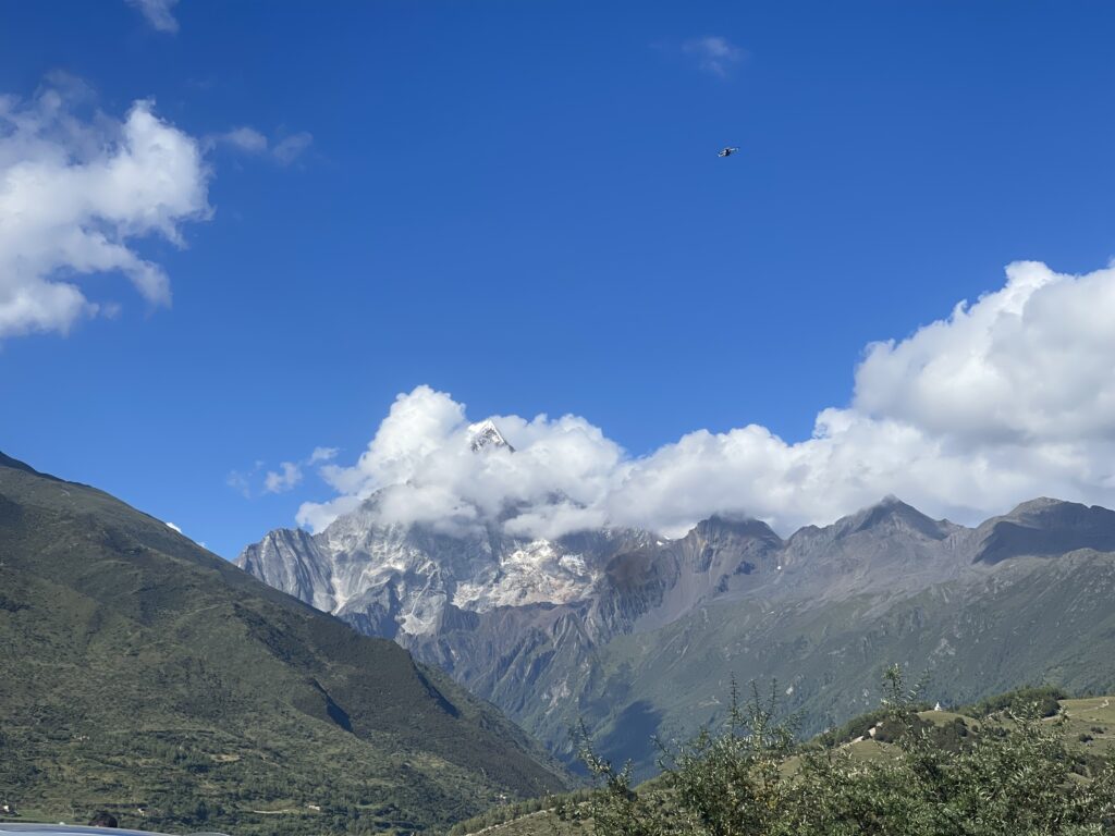
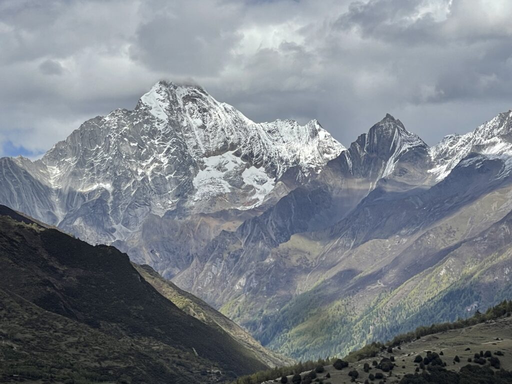
Mount Siguniang (Four Sisters Mountain, 四姑娘山) is a stunning mountain range located in the Aba Tibetan and Qiang Autonomous Prefecture in western Sichuan Province, China. It is part of the Qionglai Mountains and is one of the most popular destinations for trekking, mountaineering, and nature enthusiasts in China. The name “Siguniang” means “Four Sisters” in Chinese, referring to the four main peaks of the mountain range, each with its own unique character and appeal.
The Four Peaks (Four Sisters):
The mountain range gets its name from its four towering peaks, each representing one of the four “sisters.” The peaks rise in order from Da Feng (First Sister) to Yaomei Feng (Fourth Sister), with increasing levels of difficulty for climbers.
Da Feng (First Sister Peak): Standing at 5,025 meters (16,486 feet), this peak is the easiest to climb and is popular for novice trekkers. The summit offers stunning panoramic views.
Er Feng (Second Sister Peak): At 5,276 meters (17,310 feet), Er Feng is slightly more challenging but still accessible to non-technical climbers with some mountaineering experience.
San Feng (Third Sister Peak): Reaching 5,664 meters (18,583 feet), San Feng is more difficult and requires more technical climbing skills, offering a significant challenge for experienced mountaineers.
Yaomei Feng (Fourth Sister or Little Sister Peak): At 6,250 meters (20,505 feet), Yaomei Feng is the highest peak and the most technically challenging to climb. It is known as the “Queen of Sichuan’s Mountains” and is sought after by professional climbers for its difficult ascent and the stunning views it offers from the top.
Three Valleys:
Surrounding Mount Siguniang are three breathtaking valleys, each offering unique landscapes and trekking opportunities:
Shuangqiao Valley: The most accessible valley, Shuangqiao Valley offers a well-developed path with easy hikes and is ideal for sightseeing. The valley features glaciers, alpine meadows, lakes, and forests. It’s perfect for visitors who want to enjoy the beauty of the area without extensive trekking.
Changping Valley: Known for its dense forests, towering cliffs, and excellent views of the peaks, Changping Valley is a popular spot for longer hikes. The trek through the valley brings you closer to Yaomei Feng and offers more immersive experiences in the alpine environment.
Haizi Valley: The least developed and most remote of the three valleys, Haizi Valley is popular with more adventurous trekkers. The valley is named for its numerous small alpine lakes (“Haizi” means “sea” in Chinese) and is a key starting point for climbers attempting to summit the higher peaks.
Trekking and Mountaineering:
Mount Siguniang is a popular destination for trekkers and mountaineers from around the world. Da Feng and Er Feng offer excellent trekking routes that do not require advanced technical skills, making them accessible to casual hikers. San Feng and Yaomei Feng, on the other hand, attract serious climbers due to their technical difficulty and higher altitude.
Trekking through the valleys or ascending the peaks allows visitors to experience a wide range of ecosystems, from lush forests and meadows to barren, snow-capped landscapes. The diversity of the landscape makes for breathtaking views at every stage of the journey.
Natural Beauty and Biodiversity:
Mount Siguniang is part of the Siguniangshan National Park and is recognized for its incredible biodiversity. The area is home to a wide variety of plant and animal species, including endangered animals like the red panda, golden snub-nosed monkey, and many bird species.
The landscape features glaciers, alpine meadows, forests, rivers, and rugged cliffs. In the fall, the area becomes particularly beautiful as the trees change colors, and the autumn foliage contrasts against the snow-capped peaks.
Tibetan Culture:
The area surrounding Mount Siguniang is home to Tibetan communities, and visitors can experience local Tibetan culture, traditions, and hospitality. Tibetan prayer flags are often seen fluttering in the wind, adding to the region’s spiritual atmosphere.
Some of the local villages offer homestays or guesthouses where visitors can immerse themselves in Tibetan customs and cuisine.
Climate and Best Time to Visit:
The best time to visit Mount Siguniang is from May to October. During this period, the weather is relatively mild, and the landscapes are at their most beautiful. In spring and summer, the valleys are filled with wildflowers, while autumn brings vibrant fall foliage.
Winter is also a good time to visit for those interested in snow trekking or mountaineering, but the weather can be harsh, and the trails more challenging due to snow and ice.
Getting There:
Mount Siguniang is located about 220 kilometers (137 miles) from Chengdu, the capital of Sichuan Province. The journey by car or bus takes about 5 to 6 hours, passing through scenic mountain roads.
The town of Rilong serves as the main gateway to Mount Siguniang and its surrounding valleys. Rilong offers accommodation and basic services for travelers preparing to explore the region.
Mount Siguniang is a must-visit destination for nature lovers, hikers, and mountaineers seeking to experience the stunning beauty of Sichuan’s highlands. Whether you’re looking for a leisurely trek through alpine meadows or the challenge of summiting a 6,000-meter peak, Mount Siguniang offers an unforgettable adventure.
